
Find Your Next Getaway

Find Your Next Getaway

Playfair Display is a sophisticated font with tall, imposing letters. It's ideal for titles, headlines and short blocks of copy - like a product description.
Playfair Display is a sophisticated font with tall, imposing letters. It's ideal for titles, headlines and short blocks of copy - like a product description.
Find Your Next Getaway
Playfair Display is a sophisticated font with tall, imposing letters. It's ideal for titles, headlines and short blocks of copy - like a product description.


Water Quality
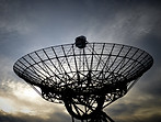
Our ever-growing database of hydrometeorological data covers the whole United States. If you are looking for a certain set of data, chances are you can find it here. Connected to that real-time data, is Hydro Qual, our suite of water quality products, which offers users the ability to access that data, as well as generate a wide variety of reports. We also offer custom programming services to help customers with more specific requirements.

Cloud Offerings
Try out our new cloud offering, the HydroDCS Cloud, where you can manage, access, and configure all of your hydrometeorological data from anywhere. The HydroDCS Cloud offers almost everything the HydroDCS offers, but also with the benefits of the cloud, which include remote maintenance, backups, and access from anywhere in the world. In addition to our cloud products, DeWilco personnel also have extensive experience configuring and managing cloud environments for our clients.

HydroDCS
The HydroDCS is a DoD approved, fully available, telemetry device capable of retrieving and decoding any time-series data. Users can easily configure their HydroDCS units to not only collect time-series data but also generate reports, all in a super secure, ultra-hardened environment. The HydroDCS can be utilized on-premises in a physical appliance or the cloud.

Cybersecurity
We have years of experience working in environments with the strictest cybersecurity standards. From DoD products to private data centers, cybersecurity is a primary focus of not only every project, but every task we pursue. We want to help you with your cybersecurity needs!

Hydrology Solutions
Zoom Sat
Our satellite imagery technology is being used by the US Army Corps of Engineers to aid in the identification of water body anomalies that would otherwise require an expensive monitoring system with cameras, or an employee to travel frequently to these locations. Zoom Sat is a user friendly, where users can identify locations of interest and view those areas from an enhanced, areal perspective. We also offer custom satellite imagery services!

Latest Updates
The world is always changing. DeWilco adapts and finds innovative approaches to address the problems that arise from those changes.


Our Services
DeWilco offers a variety of products and services that will improve your efficiency & more importantly protect your IT environment.
HYDRODCS

SATELLITE IMAGES
CYBERSECURITY

CLOUD SERVICES

DATA VISUALIZATION


